The Great Minnesota Get-Together!

A day spent wandering

the Minnesota State Fair.

The History:

The first Minnesota State Fair was really a county fair in 1954, but after acquiring statehood in 1958, the first state fair was technically held in 1959. Since that time, it has been held annually with only six cancellations due to the Civil War, The US-Dakota Conflict, the Chicago World’s Fair, World War II, a 1946 polio epidemic, and in 2020 due to COVID-19. Because COVID-19 really isn’t over, I thought I’d skip this year, but a surprise day off of work and a rainy day meant smaller crowds, and my curiosity got the better of me!

Some Logistics:

The state fairgrounds are now permanently located in Saint Paul, MN on 322 acres. Park-and-ride buses will take you from local churches to the event for free, and a standard adult admission was $16. If you ever plan to attend, bring your walking shoes!

The Food:

Fair food is its own category, and Minnesotans look forward to the food as much as anything else. State Fairs are synonymous with food-on-a-stick, and Minnesota is no exception, providing corn dogs, pizza, walleye, and even key lime pie on a skewer!

The Pronto Pup

Well-known is the famous “Pronto Pup,” a corndog that has been using the same batter since it began selling in 1947! Curious, this vegetarian even ordered one. They batter them right in front of you and apply a ferris wheel of sorts to ensure each Pup gets 2min, 15 seconds of fry-time. The attendant painted it with ketchup for me and… I really didn’t like it. The batter was ok, but the dog was gross, so I just ate the batter off and threw away the rest. Some traditions are great, this one should maybe be skipped.

Mini-Donuts

One food tradition that I really enjoyed, though, were the mini-donuts! For a couple of bucks, you’ll get freshly fried and dusted mini donuts in a bag. They were warm, sugary, and delicious! Bonus points for letting me see how the process works!

The Corn Roast

A popular stop along a fair-goers food journey is at the corn roast, where yesterday-picked corn is husked, charred, and buttered for you. Eager to try the high-heat Iowan favorite, I got one and… no char. Minimal butter. I mean, it was a lovely ear of corn, but what I was served was exactly what I’ve always had… perhaps the roaster was still heating up for the day? This may warrant a second-try next year.

Those were all the typical fair foods that I sampled, but also available are crowd favorites like cheese curds from “The Mouth Trap,” Sweet Martha’s cookies in buckets, potatoes fried every which way, and hot dogs. But I resisted much of these temptations because 1) the portions were enourmous. I mean, I got, like 20 donuts with my order. Since I was alone, I couldn’t justify a bucket of fries or cookies. And 2) there was so much to explore, I certainly couldn’t spend all day eating!

The Livestock:

Still a celebration of farmers throughout the state, the State Fair becomes the temporary home to hundreds of animals during its 12 days. Entire buildings are dedicated to cattle, sheep/goats, horses, and pigs. Multiple events are held with these types of livestock, but the one I was sad to miss was the 4-H Llama and Alpaca Costume Competition, where young adults and their llamas dress up together. Next year!

Also fun was the Miracle of Birth Center, where mama animals and their recent young hang out to be pet. Just check out these cute kids!

The Creative Competitions

And, finally, the real reason I came was to scout out the competition. A new resident of Minnesota, I decided to submit my lemon cayenne cookies to the State Fair in the hopes of a blue-ribbon. I’ll get the full score of my cookies in a week or two, but no ribbon this year! I did still enjoy seeing the sheer number of submissions. My cookie category alone had 86 entries!

And outside of baking, there are competitions and ribbons for knitting, woodworking, glass blowing, honey harvesting, vegetables, giant pumpkin growing, and so much more. Most impressive, to me, were the seed art creations. Using only seeds, or rice in the winner’s case, amazing art was created by artists across the state.

The Entertainment

Sprinkled all day and around the fair are free events one can stumble upon. Throughout my wanderings I watched a musical called, “History-on-a-Schtick!” all about the state and the fair, “The Flyin’ Hawai’ian” semi-acrobatics show, the daily 2 PM parade, and a lumberjack showcase.

In Conclusion

Next year, if the pandemic is under better control, I recommend attending the State Fair. And bring a dozen of your friends so you can share these massive quantities of fair food!

Aspen to Crested Butte Hike

Through-hiking the Colorado wilderness

Aspen is well-known for their celebrity-frequented ski resort. I, personally, do not care about ski resorts. The reason we went to Aspen is for the legendary through hike across West Maroon Pass linking this ski town to Crested Butte. I’ve written about Crested Butte before, so this post will just focus on the hike between the two, with a bonus of pictures from our lovely time in Palisade on the way to Aspen.

Aspen to Crested Butte via West Maroon Pass

Although AllTrails.com lists this hike as 10 miles, I counted closer to twelve. By far the longest hike I have ever done, I was nervous setting out in the predawn stillness. Since this hike is one way (for reasonable people) our friends started in Crested Butte while we started in Aspen, exchanging pictures and car keys when we met on the trail. Amber and I had the longer uphill, but the downhill was quicker and brought us ever-closer to Secret Stash pizza.

One of the most popular hikes in Colorado, the Maroon Bells are massive and impressive, and right off of a parking lot. We were soon able to leave the sunrise crowd behind as we ventured deeper into the mountains.

Throughout the first quarter of the hike, we passed through forests, scrubby bushes, and tundra in the brightening sunshine.

This picture was taken maybe an hour into our journey. I know, I know – they don’t look any closer!

The grade of the hike continued to increase, ranging from a 10-50% incline which made us grateful for our hiking poles. As we slogged our way up the steep, muddy trail, we received a welcome site – Jen and Kim already past the pass and nearing us! We paused to share stories of what the other had in store, then continued on our exhausted, uphill, merry way.

Finally! We defeated the treacherous, thin, muddy trail and approached West Maroon Pass. We hid from the wind and enjoyed snacks, as well as a much-deserved Summit Claw.

Jen and Kim even got to meet three goats when they were at the pass! Returning from a backcountry hunting adventure, man and goat were clearly exhausted, but happy to hang.

As for Amber and I, we were delighted to only go downhill for the remaining 4 miles. We speed-hiked with the idea of pizza on our brain.

SO close to the finish line.

In summary – alpine hiking is hard! But that day I hit over 30,000 steps for the first time ever and I felt quite accomplished once we were in the car. Sadly, we still had a 45 minute drive between the other trailhead and pizza, but the company and views on the road made it all worth it!

Bonus: Palisade

Known as the Peach Capital of Colorado, Palisade is a surprisingly lush valley where you can get a massive assortment of fresh fruit and wine in a super small area. There are more than 25 wineries in this town where the population is less than 3,000 people. That’s insane. Amber and I chose two wineries where we could sip and relax outdoors and had a really nice time before our strenuous hike the following morning.

Related Posts:

Ouray (and Telluride)

The Switzerland of North America

This small town is surrounded by mountains, so it doesn’t have room for a ski resort. Because of this, Ouray (pronounced “yur-ray”) maintains its charm despite its gorgeous surroundings that would otherwise lead to droves of rich tourists. That doesn’t mean it’s cheap, however, since it’s quite remote and fairly far from interstates. It’s a must-visit if you want more mountains in your life (which, obviously).

Ouray

The Million Dollar Highway

So nicknamed because it’s rumored to have cost $1 million per mile of road, the incredible drive up US Route 550 also boasts million dollar views! The day we drove up from Durango, it snowed much of the afternoon. My friend, Amber, joined me as we caught the road just after the snow melted on the roads, but decorated the scenery. She took these photos below.

Not for the faint-of-heart, this drive has hairpin turns, cliff edges, and steep inclines/declines. I had to distract Amber with picture-taking so she wouldn’t worry about the cliff edges we drove across. I recommend stopping on the shoulders (when available) to take photos of the incredible views!

Hiking around Ouray

And I mean literally. There’s a 5.5-mile loop called the Ouray Perimeter Trail which takes you from downtown to a large, and often steep, circuit of the entire town, stopping at nearby landmarks.

Amber, Kim, and I started this hike just after work, and it took us several hours, so we did the last quarter in pretty much darkness. The darkness part was silly, but we still really enjoyed our time through the mountains!

Downtown Ouray

In the interest of saving money and reducing exposure, I didn’t spend much time in Ouray’s wonderful restaurants, but I did splurge on dinner at Ouray Brewery. Great beer and my dinner of nachos was delicious! There’s also so many of shops and historic buildings along the adorable Main Street that were really fun to explore. I personally recommend the chocolate shop!

I can’t recommend Ouray enough. If you’ve got the time and ability to get there, you’re sure to find beauty everywhere you turn.

Telluride

Amber and I took a day off to explore Telluride. Just an hour from Ouray, it’s a famously expensive ski town in Colorado, but has some really great things about it as well.

The most important thing to do is to take the gondola. Considered the first free public transportation in the United States, the gondola annually moves close to 3 million people from Telluride to the Mountain Village.

At the top, you’ve arrived in the Mountain Village. We had a fantastic lunch there, then fantastic cocktails at the Telluride Distilling Company before rushing back down the mountain as our parking meter ran out!

Cornet Creek Falls Hike

This hike starts at the edge of town and is supposedly short, but is so steep it just rips the breath from your body. Already quite used to alpine hiking after a week of long, arduous hikes, Amber and I still thought this 0.6 mile trek was tough. Plenty of time to catch our breath at the top, though, and the 80 ft waterfall was amazing.

Telluride The Town

Main Street is lined with shops and restaurants (and realtors selling terrifyingly expensive homes). We enjoyed the farmer’s market we caught on our way to the Gondola, then stopped at the Telluride Brewery location just outside of town for scenic beers outside.

Both of these mountain towns were so cute and delightful. The weather was great for our trip, and I can’t wait to find my way back there someday!

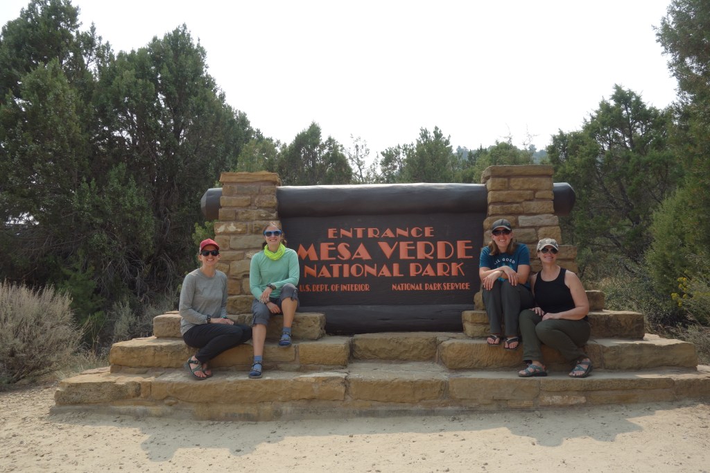
Mesa Verde National Park

A Land Wrapped in Mystery and Beauty

As our group of four set off for Mesa Verde, we estimated we’d spend maybe two hours there and move on to another hike. Five hours later, we were finally leaving and our opinions of the park had collectively skyrocketed. It’s truly a fantastic place to visit, even if the ranger tours were cancelled due to COVID.

Quick facts about Mesa Verde

Spanish for “Green Table,” this park sits about forty-five minutes from Durango. Since it’s far closer to Utah than Denver, I’d never had an opportunity to go before. It was deemed a National Park in 1906 and named America’s first UNESCO World Heritage Site in the 70s. And hopefully you’ll understand why after seeing these epic constructions.

To and From the Loops

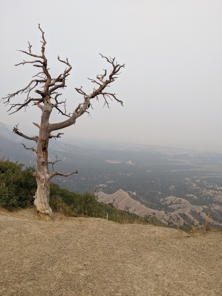
It takes about forty-five minutes from the park entrance to the Mesa Top Loop. Longer if, like us, you stop at every viewpoint along the way. The air at this elevation was filled with wildfire smoke from the west coast at the time. But luckily it cleared up as we continued to climb to the 8,500+ feet of the archaeological sites.

The Archaeology Tour

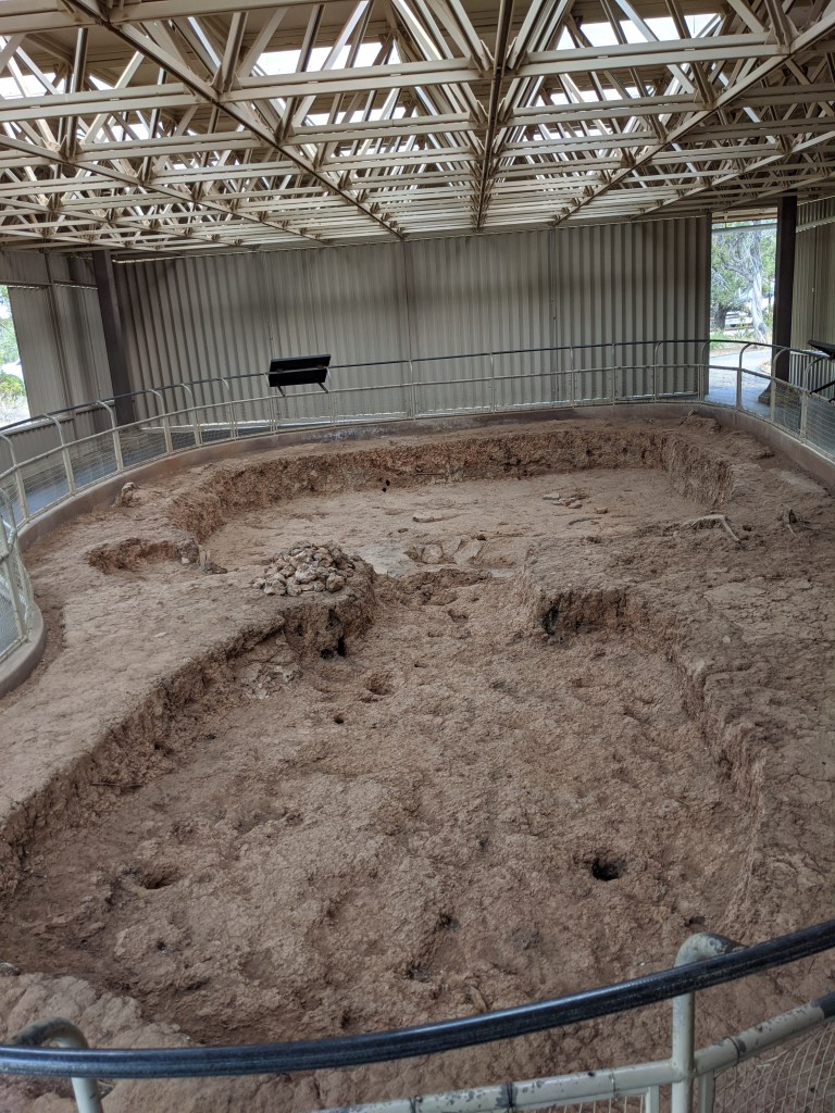
Our trip to Mesa Verde was substantially enhanced by a free audio tour app the park put together, which narrated the history of what we saw as we visited each stop on the Mesa Top Loop. Actual archaeological dig sites were made open to the public in airy buildings, to better appreciate the history of the Ancestral Pueblo people. I’ll take you through our tour now.

Pit Houses 550-750 CE

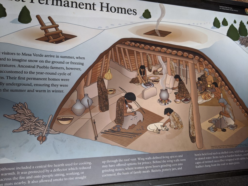
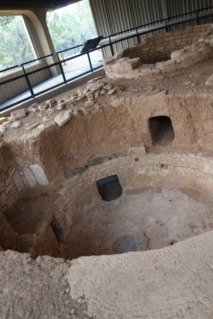
The first stop on the loop was the pit house. Ancestral Pueblo people dug into the earth and used the shallow opening to add structure to the house they built on top. At this time, they built with logs and mud and had to fix up the damage after every winter.

Single Story Villages 750-1100 CE

Eventually, the builders switched to masonry when they constructed their villages. Impressive buildings, like this much deeper home dug for a family, were a blend of stone and mud as the residents honed their techniques.

Multi Story Villages 1100-1200 CE

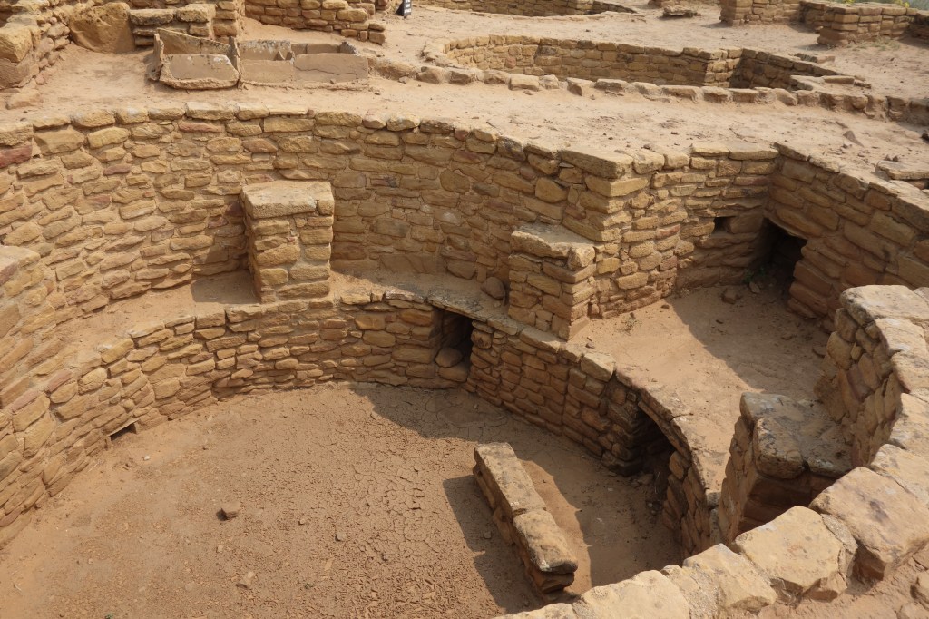
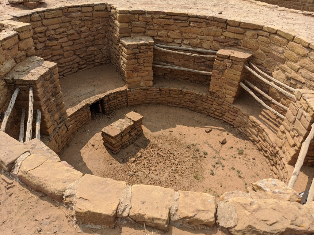
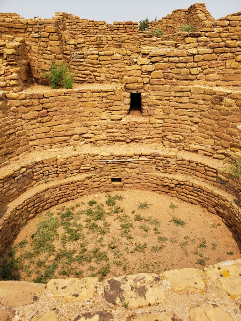
You can see the villages get more sophisticated as you travel the Mesa Top Loop. But the best example of these were at the Far View Sites located before the Loop. There we could see impressive, well-constructed villages composed of rooms and kivas all set in their close, wall-sharing glory. The kivas, like the one pictured immediately below, were used as community gathering places, and had the perimeter bench for seating as well as a chimney for air flow.

Cliff Dwellings 1200-1300 CE

For reasons still not known to us, the Ancestral Pueblo people moved from their very much horizontal villages to building structures on the sides of cliffs. Elaborate rope systems were used to go from the village to the surface, and bricks were pulled from their previous villages to aid in the construction of these amazing creations.

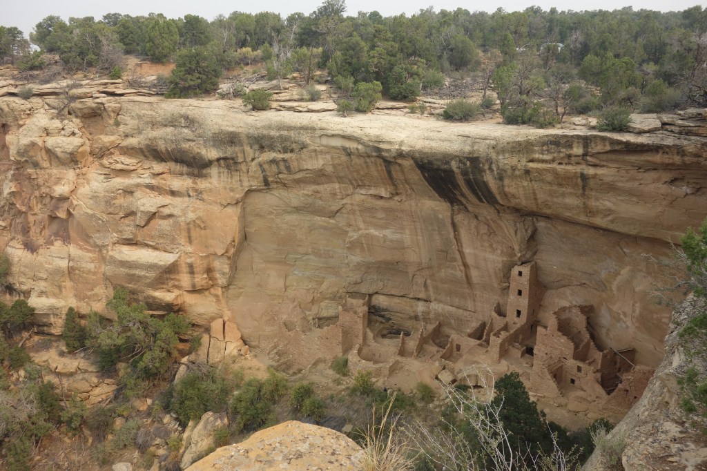
Square Tower House is located near the beginning of the loop, and it just comes out of nowhere in terms of how impressive it looks compared to the pit houses before it! It’s an excellent set up for the later cliff dwellings.

Cliff Palace

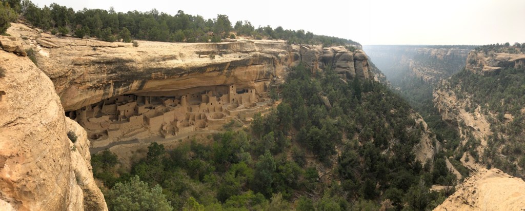
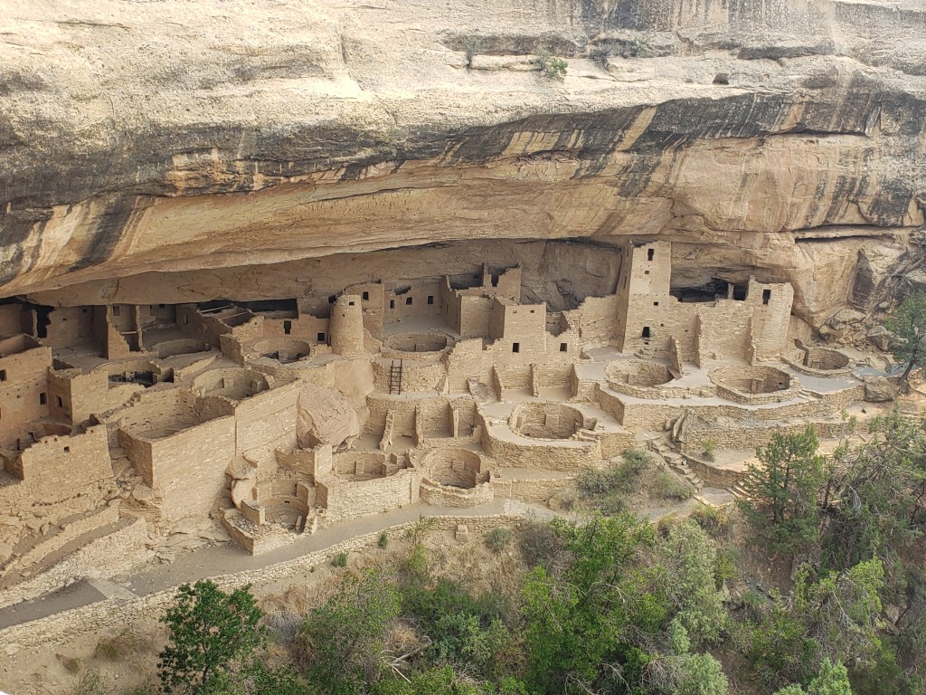
It’s impossible to feel the scale of this feat from a picture, but know that Cliff Palace, as pictured below, holds 150 rooms and 23 kivas. It is believed it was the home to 100 people. This is where the best ranger-led tours happen.

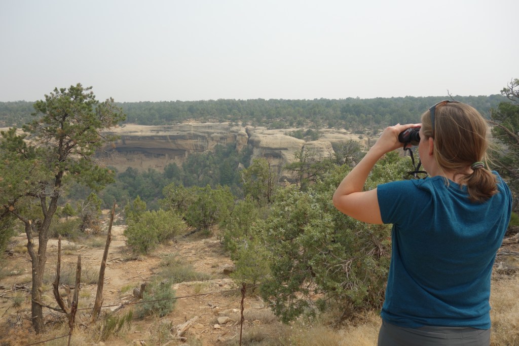
Overall, we were wildly impressed with Mesa Verde National Park and were so glad we brought binoculars to appreciate the details from our mandatory distances. Luckily the viewpoints throughout the park got us pretty close to the action, but here’s Cliff Palace from a distance in case it helps with scale!

If you’re going to be in this corner of Colorado, you’ve got to visit this park. Maybe by the time you visit, ranger hikes will return and you can see Cliff Palace up close in it’s majesty!

Durango

Colorado lost in time

Known for white water rafting, zip-lining, and trains, Durango brings in a variety of people from all over. But, six hours from Denver means fewer people are willing to make the trek to these western slopes. Since we were already halfway there at Great Sand Dunes National Park, Durango was much more approachable and we enjoyed our time there!

On the drive

The drive across the San Luis Valley, then through the San Juan and Rio Grande National Forests was a beautiful one. We went through Wolf Creek Pass and stopped at the top to appreciate just a smidge of the Continental Divide!

Going down from the pass, we stopped at a couple of viewpoints to take pictures of the beautiful drive.

We stopped in Pagosa Springs for a much-needed stop where we enjoyed Mountain Pizza and pour-your-own beers!

We even stopped to check out Chimney Rock, but found the per-person pricing to be a little steep. So, here’s a picture of it from a free distance.

The rest of the drive was easy and there are so many hotels/motels in Durango you’re sure to find a vacancy for the night!

Hiking

There are, of course, innumerable hikes surrounding Durango. We opted for a couple of hikes, as the real reason we came here was for Mesa Verde National Park. More info on that park in this post.

Purgatory Trail

With a comforting name like Purgatory Trail, we were a little skeptical. But twenty-five miles north of Durango was the small lake which gave the trail its name. Normally a ten+ mile out-and-back, we opted to hike about three of those miles as it was early evening and hiking is no fun at night.

Unusually for Colorado, the hike starts at the highest point, so we had the effortless task of walking downhill the first half, anticipating the obviously much harder hike back up to the car.

We were rewarded with just-turning Aspens, babbling creeks, and beautiful scenery. Definitely recommended for anyone who wants beautiful landscapes and forests!

Canyons of the Ancients National Monument

An hour west of Durango and fairly close to the Four Corners area, is a place called Canyons of the Ancients National Monument. This area was large, so we opted to hike (again) only a small portion of a very long out-and-back trail called Sand Canyon. Plus, it was entirely exposed and stupid hot that day, so we were all grateful to get out of there, despite the interesting sandstone and ruins!

Local places to eat and drink

I wish we could have experienced more of the excellent brewery and restaurant selections available in Durango, but COVID-19 and time constraints made it more difficult. We were able to try some brews at High Trestle Brewing Company, and I got a box of tasty doughnuts from Durango Doughworks!

Before leaving Durango, we needed to check out of our hotel, but we also needed internet for work. So, we found Durango Coffee Company and luxuriated in their cozy interior; sipping on their crafted warm beverages as snow began to fall!

We were all happy to spend more time than expected in Durango, but there’s so much more we didn’t do. I’d love to go back and check out even more exciting things.

Great Sand Dunes

A Totally Different World Hidden in Colorado’s Mountains

I recently took a trip with three awesome women around the mountains of Colorado. Seeking a socially distant way to have an adventure, we ended up at three National Parks and some wonderful hikes. This post is going to be dedicated to our first stop: Great Sand Dunes National Park.

The Dunes

Three and a half hours away from Denver, this park is far off the beaten path. Getting there was easy, though, with quality roads and directions.

We camped just across from the park at the Sand Dunes Oasis. There they rent sand boards and have food available. Pro tip – you really don’t need a sand board, and the lines are nasty long so I’d just stick with a hike. I’ll go into more detail on that later. If you’re there for the night, enjoy the stars in the dark skies and hopefully you catch an epic sunset like we got:

High Dune

There are two large dunes you can hike – Star and High Dune. The difference in height between the two is only fifty feet, but Star Dune takes three to four times as long. We opted for the 2 hour round trip of the 700ft tall High Dune.

Now, sand dune hiking is odd. Each step up has you sliding a little bit down as well, so it is effort to hike these things. There’s also no set path, as you can see by the not-entirely-helpful trail map we passed:

It’s a total free-for-all on your path, we hiked a mixture of ridge lines and steep walls of sand to get us to the top. Our breathing was heavy, but the rest on top with our summit drinks made it worth it! In the cooler morning, we rocked bare feet. But once the sand gets hot, a pair of socks is all the footwear you need to keep the scald off your toes.

There’s just no communicating the sheer scale of these dunes. Ninety percent of the sand of the park is within a massive stretch of flat, rocky sand at the beginning. Followed by massive, rolling hills of sand that take forever to scale, and seconds to sprint/fall down. This is why I don’t recommend sand boards – because of the walk back up the steep sand. I also recommend you get into the park as early as possible. As we wrapped up our hike around 10 AM, the sand was already almost too hot to stand on. Not to mention, there was already a massive line to get into the park at the Entrance Station.

We all really enjoyed our time on the Dunes, and especially enjoyed the hammock naps back at our campground right afterward.

Nearby Hiking

Although Great Sand Dunes National Park looks to be in the middle of nowhere, there’s a number of non-sandy hikes either in the park or nearby. We opted to try one that’s only ten miles from the park. However, five of those ten miles may take up to 45 minutes to drive. It is among the rockiest, bumpiest roads I’ve driven, but the hike at the top is easy and worth it.

Zapata Falls

Just a half mile from the trail head, the 30ft waterfall is hidden from the dirt trail. If you want to see this multi-step waterfall in all its majesty, you’re going to need to walk through the creek. In September when we were there, the water was quite low but quite cold. I’ve been there in May as well and don’t remember high water in the creek, but the waterfall was half frozen still from winter. It really is an impressive site; loud and so close!

I hope you get a chance to explore this fascinating National Park. It makes for a great weekend trip and you feel like you’re in another world!

Indiana Dunes

A Peculiar National Park

Originally designated a National Lakeshore in 1966, the Indiana Dunes were converted to a National Park February 2019. This has led to some… identity issues as there are zero signs for a National Park, some signs for a National Lakeshore, and to top the confusion there’s an Indiana Dunes State Park within the National Park? I don’t think I ever saw a park ranger. This “Park” is pretty cool, but sprawling and disparate. It runs along the bottom edge of Lake Michigan, so most people come for the access to the beaches. As avid hikers, though, we opted to camp and take a few of the better-known hikes instead.

3 Dune Challenge

This particular hike actually took place not in Indiana Dunes National Park, but Indiana Dunes State Park. I found it via the National Park app, but what can you do? I paid the $12 outsider fee and we found Trail 8 – otherwise known as the “3 Dune Challenge.”

This hike got off to a lush, weird start with a boardwalk over a marsh, followed by a forested trail – but the trail was made of sand! Luckily, there were clear signs posted at every intersection to keep us on the right path as we navigated this strange environment.

Dune 1 – Mt. Jackson – 176 ft – 31°

Dune 2 – Mt. Holden – 184 ft – 38°

Dune 3 – Mt. Tom – 192 ft

This section was so steep at 43°, there was a staircase instead of scrambling tourists. Alex took this moment to rid his shoes of some of the sand that had crept in.

The 3 Dune Challenge was a great hike with just enough difficulty in the 552 vertical feet of climbing over 1.5 miles. We enjoyed this excellent introduction to the area.

Mt. Baldy

Mt. Baldy is a large dune in the area, but is currently closed for preservation. An interesting fact from the National Park Service:

“Mount Baldy is ‘starving’. Beach erosion is taking away more sand than the waves are bringing in due to the breakwall that was built for the Michigan City Harbor. To try and correct the effect of the breakwall the U.S. Army Corps of Engineers began feeding the beach in 1974.”

The dune itself was closed, but the beach was open and from a small cliff edge we were able to watch the beautiful sunset next to the Chicago skyline in the distance.

Cowles Bog Trail

This nearly five mile trail starts with a boardwalk over a bog, flows through some sandy forest (watch out for the poison ivy everywhere!) and even walks along the beach of Lake Michigan. I recommend going counter-clockwise on this loop to get the sharp descent in the sun and the steep ascent in the shade, instead of the reverse.

Summary

Overall, we rated this National Park the worst one we’ve been to, but it was still kind of neat. It feels disorganized and not very park-like. If you’re in the area, it’s totally worth stopping by, but I’d limit the drive dedication to around 3 hours – any further and there’s probably somewhere more interesting you can go instead!

Maine in Summertime

In an effort to satiate my desire for adventure this year, I reached back in my photos so I could write about a wonderful trip we took to Maine in 2018 – I hope you enjoy!

Four days of coastlines and sightseeing

Portland (the one in Maine)

After arriving at the Portland Jetport (Portland Airport was already taken), Alex and I found where we were staying downtown and settled in.

East Promenade

The following morning was the fourth of July, and the town was aflutter as a result. The weather was hot and sunny, we began our trip with a walk along the Eastern Promenade. Embarassingly enough, I didn’t take many photos, but we returned that evening for some fireworks over the water, so here’s a fuzzy photo of that!

Fort Williams Park

Our greatest photo op was at the quintessential lighthouse pictured at the top of this page – the Portland Head Lighthouse. You can see this lighthouse by going to Fort Williams Park along the coast, and it’s quite busy. There’s lovely walkways leading right up to the lighthouse.

Allagash Brewery Tour

Allagash Brewery is considered to be one of the grandfathers of American craft beer. We booked a tour ahead of time and got to sample some of their finest – including the classic Allagash White! Before the tour, we grabbed some tasters. You know, for science.

Peaks Island

A truly delightful afternoon was spent taking a ferry across Casco Bay to Peaks Island. For very cheap, you can rent a bicycle and bike around the entire island (about five miles). We stopped at Cairn Beach where dozens of rock piles had been created on the rocky beach. Here’s a picture of the most impressive one.

Portland Restaurants

Taco Escobarr was just across the street from where we were staying. They have traditional and unusual toppings for their tacos and when we asked if they had any hot sauce, we were brought a basket full!

Since I had never had a lobster roll before, we stopped at High Roller Lobster Co and I enjoyed my (surprisingly cold?) but picture-perfect lobster roll!

Honorable Mention also to Blue Rooster Food Co – a delightful sandwich shop near the port that was a great stop from the afternoon heat.

We loved Portland and wished we could spend more time there, but what a whirlwind of fun and adventure we were able to squeeze into two days!

Acadia National Park

Acadia National Park is a three hour drive from Portland, but it is so worth it. Hours from the Canadian border, it is green and smells of salt spray. Situated next to Bar Harbor, it quickly became one of our favorite National Parks.

Hiking

Beehive Loop

The one must-do hike at Acadia is the Beehive Loop Trail. Just 1.5 miles round trip, but criss-crossing a small rocky mountainside. The views of the ocean only get better the higher you climb. At the summit there’s a sign denoting you’ve made it to 520 ft above sea level. Coming from the land of 14,000 ft peaks, we just had to take a picture of it. Not recommended if you have a fear of heights, but the hike was absolutely delightful!

Gorham Mountain

We tacked onto the Beehive Loop with a loop up Gorham Mountain. It wasn’t as adventurous as the Beehive, but this loop took us past the beautiful Bowls Lake and through more lush forests.

Dorr Mountain

At a summit of over 1,200 feet, Dorr Mountain is the first place in the U.S. to see the sunrise in winter. Sadly, we couldn’t make sunrise, so we drove up the mountainside in the early evening. Absolutely worth it, though, for the wind-swept views!

Rock Climbing

The highlight of our entire trip was rock climbing at the ocean’s edge at the Otter Cliffs. Here, you start at the top of the rock wall, rappel down to the ocean, and climb back up. It’s really amazing, and the sound of crashing waves will never leave your ears. We hired a guide to show us the best routes to climb. It was rainy, which meant fewer people, but also it meant slippery holds! Every ascent was well-earned!

This chimney climb was our last climb of the day and by far our favorite!

Bar Harbor

Because Acadia is situated next to a town, we waited out the afternoon’s rain by hopping around the local restaurants. I’m ashamed to say I didn’t take any pictures, but I had my first raw oyster (not for me) and wild blueberry pie (all for me)! We enjoyed the atmosphere of the small (but pricey) town. And, since we were on a budget, we decided to drive the hour to Bangor and stay at a cheap hotel there.

Bangor

This small town was homey and simple to visit. We spent some time around Bangor and it’s neighbor city, Brewer. After a full day of Acadia, I will still able to get down by the Penobscot River and try my first official New England Clam Chowder! So warming after a day in the rain.

The next day, our first stop was the iconic Paul Bunyan statue. For whatever reason, Bangor, ME and Portland, OR both made 31 foot statues of Paul Bunyan in 1959. The internet says the Oregon one is more famous, but I find it much uglier. We loved this 3,700 pound masterpiece, complete with ax and peavey. The statue was massive, and a delight to see!

After the statue, we stopped at two breweries (Geaghan Brothers and Mason’s Brewery) and enjoyed walking down the flower-filled riverwalk behind Mason’s. Really great way to start an afternoon.

After the brewery and riverwalk, we then headed just outside of town to check out the Bangor City Forest. Our first time in a marshland, we loved walking the boardwalks over the Orono Bog and enjoying the shady trees on our hike after the bog.

Alas, we had to leave Bangor and head back to Portland for our morning flight. We stopped, though, in Freeport where we got to visit the flagship LLBean store and it’s 16 foot tall rubber-bottomed boot out front.

After that stop, we headed to the Sea Dog Brewing Company located in Topsham on the edge of the Androscoggin River. (For those keeping score, that’s 4 breweries in as many days.) Our beers next to the river were the perfect end to a fantastic trip!

If you haven’t been to Maine, you really must go. We have nothing but fond memories of the beer, sights, and adventures as we romped up and down the Atlantic coast!

Drive-Through National Parks

Beautiful vistas without the effort!

Canyonlands National Park

Canyonlands is split into three sections due to the Colorado and Green rivers dividing it. The Needles and The Maze are best used for backpacking and off-roading trips, so we stuck to Island in the Sky, nestled between both rivers. This section has either really long trails or tiny little ones. Since we were exhausted from Arches, we opted for the tiny little ones and viewpoints.

Mesa Arch

A small half-mile hike will get you to the Mesa Arch. This short, but wide, arch holds a staggering view past its frame and is worth the tiny hike.

Viewpoints

Other than another half-mile hike to the Upheaval Dome caldera (which didn’t photograph well for us), we stopped at the Green River and the Grand View Point Overlooks. Both provided stunning views of the river-eroded landscapes.

My silliest viewpoint experience was when we tried to get to the park 24 hours earlier – it was snowing so they closed the road in! And for good reason – I took the below photos a day apart, just outside the visitor center at an overlook:

Colorado National Monument

Like Canyonlands’ Island in the Sky, the Colorado National Monument offered wonderful views from the top of the cliffs. A steep drive (with a delightful munching goat!) and some small tunnels brought us to the top where we could better appreciate the views. Many of the trails seemed to lend themselves to one-way travel, so we opted to drive by most of the overlooks and enjoy the views on our way back to Denver. With our National Park Pass it was free to us, but was a bit underwhelming after the impressive views of Canyonlands. Much greener, though!

My recommendation is if you’re in the area of either of these parks, stop by. I don’t think I’d go out of my way, though, as we didn’t have a need to spend much time at either. I suppose we’re getting jaded from all our other beautiful adventures!

Arches National Park at Thanksgiving

Exploring Nature’s

Unwalkable Bridges

Over Thanksgiving weekend, we decided to #optoutside instead of Black Friday shop. We stayed in Moab and explored both Canyonlands and Arches National Parks. It was also on this trip that we celebrated our first anniversary! Many LangeTime Adventures were had.

Arches National Park has over 2,000 documented arches in the park, but only a few are the real stars. I broke our time there into chunks to discuss below.

Windows Area/Balanced Rock

The first area of Arches we explored is called the Windows area. On the way, there’s a quick stop off for a tiny trail around the Balanced Rock where you can see a 3,600 ton boulder sitting on its eroding pedestal. That’s the weight of 27 blue whales.

In the Windows area, a short walk will take you to the North, South, and Turret arches. These are massive and you can walk right up to them to see the beautiful landscape behind.

Our favorite part of the Windows area was Double Arch. Sharing one support side, these two arches are graceful, majestic, and massive, with the southern span soaring 112 feet above the ground!

Devil’s Garden

The Devil’s Garden is an area that quickly turns tricky. About a mile from the trailhead, you can enjoy the smaller Pine Tree Arch on the way to the fantastic Landscape Arch. Landscape Arch has the longest span of any arch in North America (and 4th globally) at 306 feet . Pictures can’t really do the scale justice.

Up a slippery rock face and through some sand and water you can continue past Landscape for a look at both Navajo and Partition Arches. Partition was probably our favorite as it so perfectly framed the gorgeous view below us!

Fiery Furnace

Fiery Furnace is an area of Arches that has no designated trail. You either need a hiking permit ($6/each) or to go on a Ranger-Guided Tour. It’s not a path so much as a maze. We knew we had to do it, and tried to follow the tiny brown arrows and immediately got way off track. We climbed a huge sandy hill, and in finding a way back down found that we had to perilously scramble down difficult and steep rock ledges. We determined it was a great test of our marital problem-solving and really enjoyed climbing all over this natural playground.

Delicate Arch

This iconic final arch is the symbol of the Utah license plate. At 60 feet tall, it’s pretty and the busiest hike at Arches. We went for the sunrise and froze our butts off. It was also the steepest hike we found in Arches, but had a lovely view at the top!

Bonus Arch: Corona Arch

Just outside of Moab, there is a trail to a beautiful, massive arch called the Corona Arch. Also on the way is the Bow Tie Arch — a so-called “pothole style” arch. The hike was about three miles and filled with delightful scenery, as well as some more adventurous parts, like a ladder or steel cables to assist in the slippery parts. We really recommend this trip if you’re already heading to Moab. It was a perfect thing to do during our one rainy day when the rain took a break.

Create your own website, free on WordPress.com.Create your own website.
Start free